Trip planner font and colour
Hello,
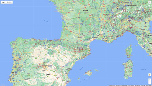
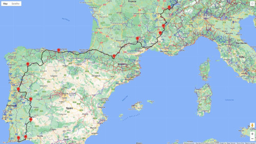
I have now spent 2 hrs trying to make a route from Basel to the Algarve in Portugual. The problem I have is that it is not possible to see the routes on the map. I have selected the countries correctly. The thin red line indicating a route is mixed up with yellow and other lines on the map. I use a Macbook and Safari web browser. I have also tried with Google Crome browser, but no improvement. For me the trip planner is of no use when I cant see the BBR routes on the map. If I select a specific route from the meny (outside trip planner) and view it on the map, the line font is much thicker and it is easy to see the route. But in the Trip Planner the font is very thin and it is very difficult to distinguish the routes from other roads, rivers, etc on the map. Can this be improved? Is there any adjustment I can do myself to make the routes more visible in Trip Planner mode?
All the best,
Andre
Hello Andre,
I'm sorry to hear that you are having problems using the trip builder.
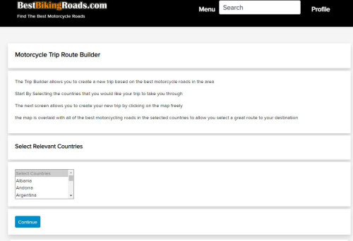
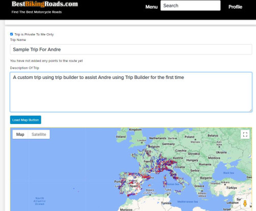
After the appropriate countries have been selected for the trip from the list, the trip builder map shown contains all the route data from the BestBikingRoads.com database for the countries selected, when create your custom trip, it will not automatically snap to the routes, so you are free to choose which of the routes you would like to follow by simply plotting over them. As you have observed, the route data lines are thinner on the trip builder than on the regular routes, this is because of the volume of data on the map, if they are shown thicker, the map itself is very obscured and difficult to see.
You create the route by adding points, until the route has been saved, it is possible to keep dragging the points around as much a you need to keep customising the route.
The plotted line for the trip is shown in a heavish black which is a compromise to suit how it will look at different zoom levels.
When you are done, simply de-maximise the map and click continue and the confirmation message will be shown.
You should also receive an email containing the link to your newly created trip.
When you visit this link, you can view your trip on the map, (this time without all the other route data so that it is a simpler view) and the saved trip is shown purple on the map.
If you click 'download GPX' you can now save the file locally for use.
That's it.
I have tried to make the usuability a compromise better as much functionality as possible and ease of use but of course, because of most of the BBR users are advanced travellers, there is a bit of a bias towards more information on the views.
If you have constructive feedback about how it can be improved, please feel free to suggest it. Ideally with a suggestion about what could be improved and how.
I hope you like my project, many thanks for supporting it.
David
Page 1 Of 1
Copyright © 2004-2026 BestBikingRoads.com · All rights reserved · No reproduction permitted without permission
